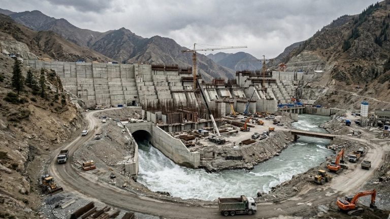


As Tajikistan pushes forward with the 3,780-megawatt Rogun mega-dam and Kyrgyzstan seeks billions in foreign investment for the Kambarata-1 project, regional planners are aggressively pitching these massive structures to international donors as pure green energy solutions. Yet flooding vast river valleys inevitably generates greenhouse gases, primarily methane from decaying organic matter. For years, estimating exactly how much carbon a planned reservoir will emit has been a blunt and highly inaccurate exercise. This persistent uncertainty leaves project developers, government ministries, and international financiers guessing whether a new dam will perform like a giant solar panel or, in the worst cases, function like a fossil fuel plant in disguise.
A critical issue lies in the standard accounting methods historically used by infrastructure developers. Planners typically rely on basic emission factors, known in the industry as “Tier 1” estimates, which assume all dams located in a similar global climate zone emit greenhouse gases at the exact same rate. According to a new study published in Communications Earth & Environment, this broad-brush approach fails to capture vast differences between individual sites. Consequently, it can overestimate national reservoir emissions by up to 50% compared to more detailed calculations. While highly detailed, site-specific emission models like the Greenhouse Gas from Reservoirs (G-res) tool exist, they have traditionally required too much manual data processing to be useful for large-scale, national planning.
To bridge this gap, researchers developed an automated framework that pulls in global satellite and geospatial data to feed directly into the G-res model. Instead of treating all dams equally, the system rapidly analyzes specific valley shapes, flooded forest cover, water depth, and runoff for thousands of potential sites simultaneously. The team also integrated an explainable artificial intelligence layer to reveal exactly which physical factors drive emissions at any specific location.
Testing this system on strategic hydropower planning in Myanmar, the researchers found that substituting generic estimates with high-resolution data drastically changes which dams should get built. By optimizing for emissions alongside power generation, planners could hit the country’s exact energy targets while eliminating 0.94 million tonnes of CO2 equivalent annually. The smarter, data-driven portfolio also conserved 239 square kilometers of forest and arable land and reduced the number of river barriers required in lower river reaches from 28 down to seven.
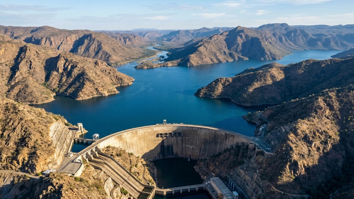
If this spatial modeling framework were applied to the Naryn River cascade and the planned Kambarata-1 project in Kyrgyzstan, planners could provide exact, site-specific emission profiles to the World Bank and the Asian Development Bank. Kambarata-1 will be exceptionally deep and located in a mountainous, cold-climate zone. The research identifies these exact variables (high depth and low temperature) as critical factors that suppress methane production. Armed with precise data rather than generic estimates that penalize the region, developers could definitively prove the project’s low-carbon credentials to hesitant Western climate funds. This is especially vital as countries prepare for stricter international carbon accounting standards like the European Union’s Carbon Border Adjustment Mechanism.
Conversely, the tool holds stark warnings for shallow irrigation and multi-purpose reservoirs in warmer, flatter regions, such as southern Kazakhstan or Uzbekistan’s Syr Darya basin. The study confirms that shallow depths and warm temperatures create hotspots for methane ebullition, a process where gas bubbles rise directly from the sediment to the surface. For regional water managers, deploying this automated framework could highlight which aging reservoirs require immediate intervention, such as surface aeration that reduces methane. It could also guide the siting of new agricultural water storage away from carbon-heavy lowland footprints.
Across the Caucasus, where Georgia is assessing dozens of potential run-of-river and smaller storage projects on rivers like the Kura and Rioni, manual emission assessments for each site can stall development for months. Automating this process allows energy ministries to rapidly map out entire national portfolios. They can prioritize projects that keep lifecycle emissions strictly comparable to wind and solar power, while confidently discarding configurations that secretly carry heavy climate costs.
However, the automated models still rely on static data and lack the capacity to account for changing physical environments. Reservoir emissions are governed by dynamic, highly localized processes like seasonal water level fluctuations and sediment buildup over decades. In Central Asian rivers like the Vakhsh and Amu Darya, which carry massive sediment loads from glacier melt, understanding how trapped silt and seasonal drawdowns impact long-term methane release remains a major blind spot. Future research must incorporate these dynamic sediment models into the automated framework to ensure accurate long-term accounting in post-Soviet river basins.
For a decision-maker (whether a regional energy minister, a hydropower planner, or a donor agency officer assessing Central Asian infrastructure), the bottom line is clear. Relying on generic emission factors for reservoir planning is obsolete and financially risky. Integrating automated, site-specific emission modeling into the earliest stages of strategic planning is now highly feasible. It ensures that billions of dollars in climate finance genuinely reduce the region’s carbon footprint.